After another pause (a few family problem) here's another leg: from Aswan International Airport, Egypt to Taif in Saudi Arabia. A mid-long flight across the Red Sea, then following the East coast and finally turning roughly West toward Taif. Also this region isn't very well covered by TileProxy. Failures on as usual.
Waiting to take-off at Aswan. Completely clear sky and 28 degrees:
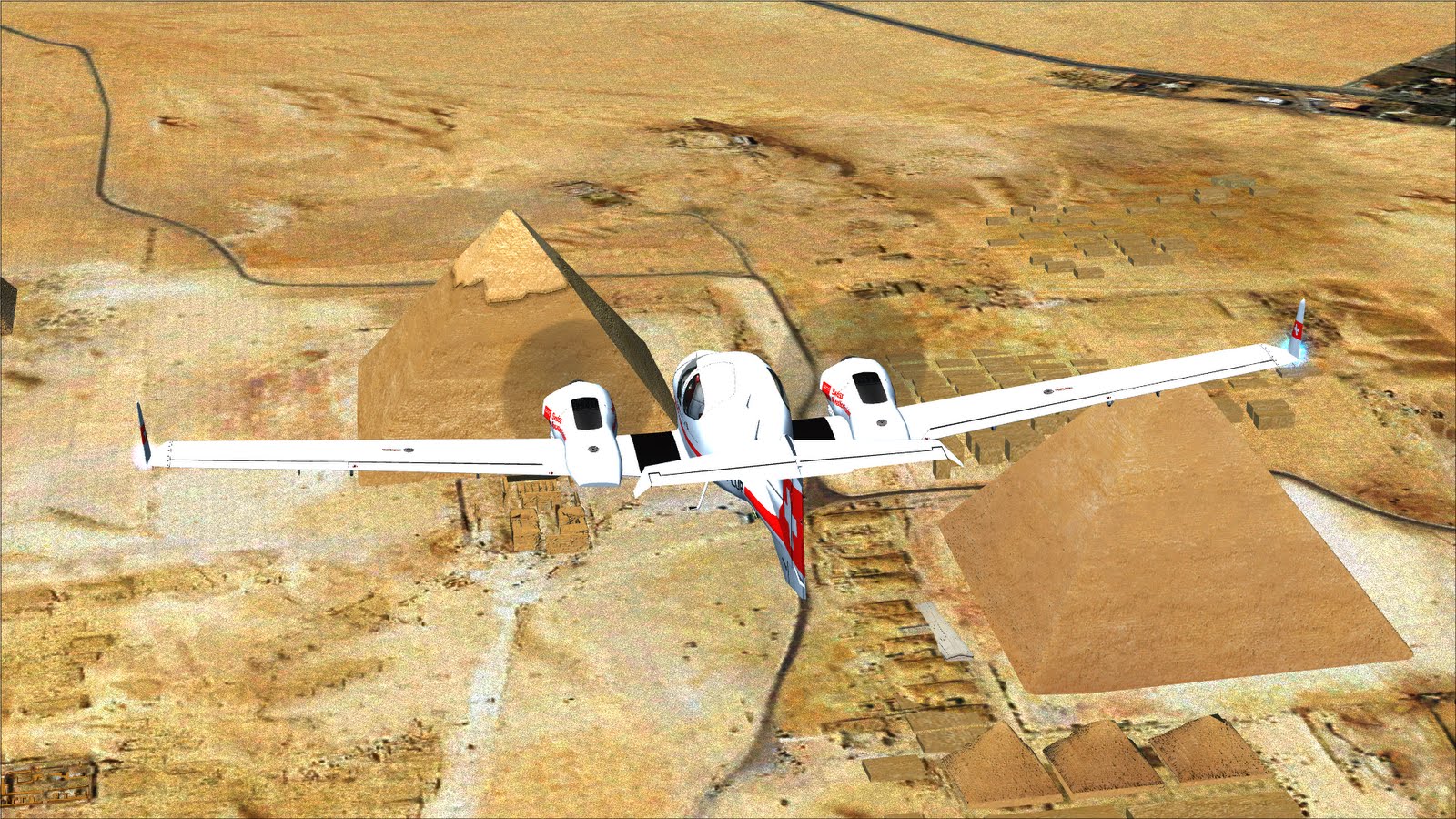
Shortly after take-off, the first problem: the nose gear does not retract. I quickly decide to keep flying, I will have to go not extremely fast, but other than that, it should be fine. Maybe the problem will disappear as time goes by:
Passing North of the Aswan dam, note how the FSX mesh is wrong (there is a kind of waterfall before the dam itself)
Shallal:
Some industrial complex, I couldn't find anything on Google Earth:
Same here:
Time to check if the landing gear problem is still there. I cycle the gear (I did that several times during the flight) but nothing happens. Pressing the test button causes the UNSAFE (red light) to come on. No way...
Crossing the Red Sea
And finally approaching the East coast. The airport that can be seen on the coast is Wejh [OEWJ]
Those small islands should be very nice, unfortunately the satellite imagery quality is very poor:
The flight proceeds
This place is called مجسم الدلة - كورنيش الرايس I did not found any translation...
Following the coast
A few miles after Rabigh airport the Twin Star begins to turn making almost a 360. I switch off the autopilot and try to understand what is wrong, then I see that the artifical horizon indicator does not work anymore. As you can see in the picture the aircraft is level, but the indicator marks a climb and a left turn. In those conditions, the NAV/HDG part of the autopilot do not longer operate and I have to fly manually from now on:
Somewhere on the right there should be the Mecca, but I am too far away
I begin to climb (from 4500 to 7500) to approach the plateau where Taif is located.
The engines have a strange noise... Indeed. By checking the fuel flow indicators, I can see that the right engine isn't working right, the Fuel Flow is less than 2/3 compared to the other (9.0 against 5.9) and I have to land pretty soon. It is not a nice situation as landing with an unbalanced thrust isn't that easy. I decide to climb higher than usual and approach Taif from a relatively high altitude, gliding and keeping the throttle to a minimum, that should reduce the unbalance problem:
Done! I had to use the rudder during the last part of the landing and also to be able to taxi properly, but at least the aircraft is fine.
Moving to a parking position. I can see a P-180 Avanti (the orange one on the right)
And while I leave the aircraft, A British Tornado comes.
Well, not bad after all. I had a few failures, more than before, and that was interesting. I will keep flying along the coast moving South and then West, coming out of the Red Sea and then in the Gulf of Aden.